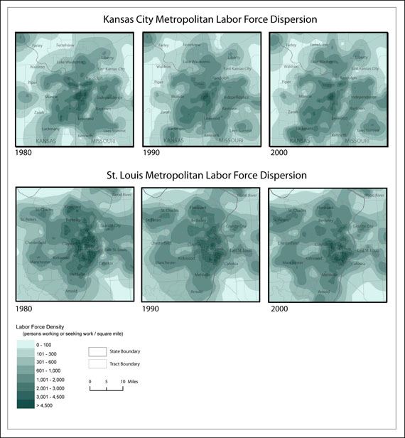
Isopleth maps of labor force density show us where workers live. A labor force density map is similar to a population density map only it targets workers specifically. Maps of labor force dispersion show a pattern of decentralization in both the KCMA and SLMA. Labor force density remains highest in downtown areas from 1980 to 2000 but decreasingly so. There is an overall suburbanization of the labor force, but this growth is not uniform. Certain areas have exhibited more growth in labor force density and have emerged as new micropolitan centers, while other suburban areas have experienced a decline.