Trend Summary
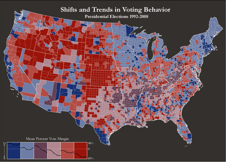
This final cluster solution combines voting margins for each presidential election and changes between consecutive election years. That is, it clusters counties by both static and dynamic variables to better visualize the political landscape of the United States. The map thereby effectively highlights Democratic and Republican strongholds (red- and blue-hued clusters), while also capturing swing counties.
This exploration in electoral geography highlights the complexity of the U.S. political landscape. It is clear that presidential elections are determined by multiple, often overlapping factors – among which population characteristics, physical location and socioeconomic variables represent only a fraction. Factors that are harder to quantify – such as the character of the candidates, the state of the economy, and the issue agenda of each campaign – also influences the outcome of an election. Therefore, the electorate’s tendency to switch back and forth in party affiliation between presidential elections can only be expected.